


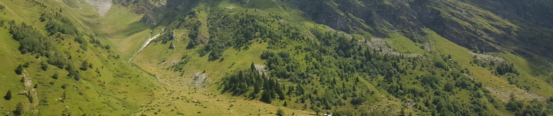
chalets du Miage

jeff2
User
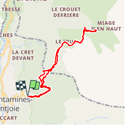

Length
9.3 km

Max alt
1743 m

Uphill gradient
661 m
Km-Effort
18.1 km

Min alt
1275 m

Downhill gradient
662 m
Boucle
Yes
Creation date :
2019-07-31 08:57:00.328
Updated on :
2019-07-31 17:27:28.875
3h34
Difficulty : Difficult

FREE GPS app for hiking
 SityTrail
IGN / Geographical institutes
SityTrail Plus
The world is yours!
About
Trail Car of 9.3 km to be discovered at Auvergne-Rhône-Alpes, Upper Savoy, Les Contamines-Montjoie. This trail is proposed by jeff2.
Description
On dirait Lâ Suisse...
Photos


Positioning
Country:
France
Region :
Auvergne-Rhône-Alpes
Department/Province :
Upper Savoy
Municipality :
Les Contamines-Montjoie
Location:
Unknown
Start:(Dec)
Start:(UTM)
324138 ; 5076887 (32T) N.
Comments